It’s been awhile since Jeep and I hit the road for adventure. This time we are visiting family in Morro Bay and Cambria on the CA Central Coast, and viewing the CA superbloom.
Day 1 – Grapevine to the Carrizo Plain and on to Morro Bay
We left early April Fools Day morning after breakfast. For those of you that have traveled with me before, you know I like to eat breakfast out. Hot coffee, eggs over medium, carcinogenic cured meats, toast and jam. This trip unfortunately started without that benediction. It was a blueberry scone, a banana, a hard-boiled egg, and of course coffee, black.
Not quite the same, but as Mick says, you can’t always get what you want.
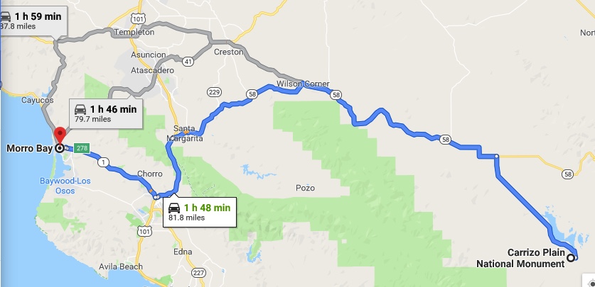
Anyway we were on the road around 6:30 and heading towards Gorman and the Grapevine pass. It’s unusual for us to go up Highway 5 instead of the 101. But this trip, we are in search of super-blooms that have sprouted courtesy of the historic rains California experienced this winter. Specifically, our route (as recommended by Barb, Gretchen’s mom) was designed to pass through the Carrizo Plains National Monument.
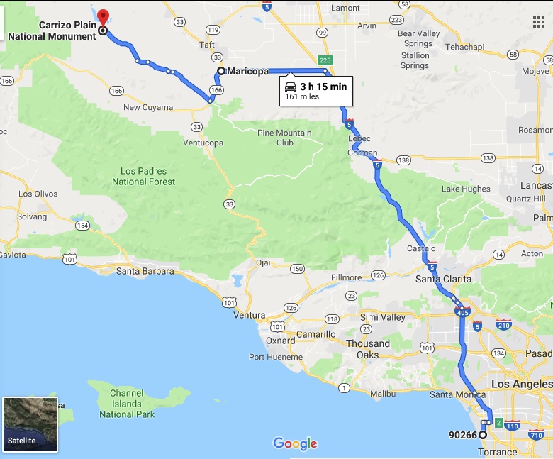
This route takes us up the 5 to the 166, to Soda Lake Road, to the 58, to the 101 and finally to Morro Bay. I know that for those readers unfamiliar with California highways will find the pervious sentence bewildering. I had the same trouble trying to convince Google Maps to create this route. It seemed to be personally offended by the effort and continually tried to reroute me along some other more conventional route. For those trying to replicate this adventure, just put Carrizo in as the destination and sort it out later.
But, having finally beat Google Maps into submission, and armed with a real paper California map (complete with a hand drawn Soda Lake Road on it), we were on our way.
Traffic out of town was as bad as it normally is at that time, but we made decent time and were soon heading up the Grapevine Pass. We were hoping to see some flowers around Gorman, but it was still a little early for anything spectacular. We stopped anyway and snapped a few photos, but didn’t linger long.
Soon we were headed west across the valley on Highway 166. This section of the highway is dead straight, with no turns, for 20 some odd miles. The road travels through miles and miles of orchards (mostly citrus), without much change. Eventually, you get to Maricopa, where we refilled the gas tank. The road then heads southwest out of town. In about 10 miles you get to the Soda Lake Road intersection and turn right.
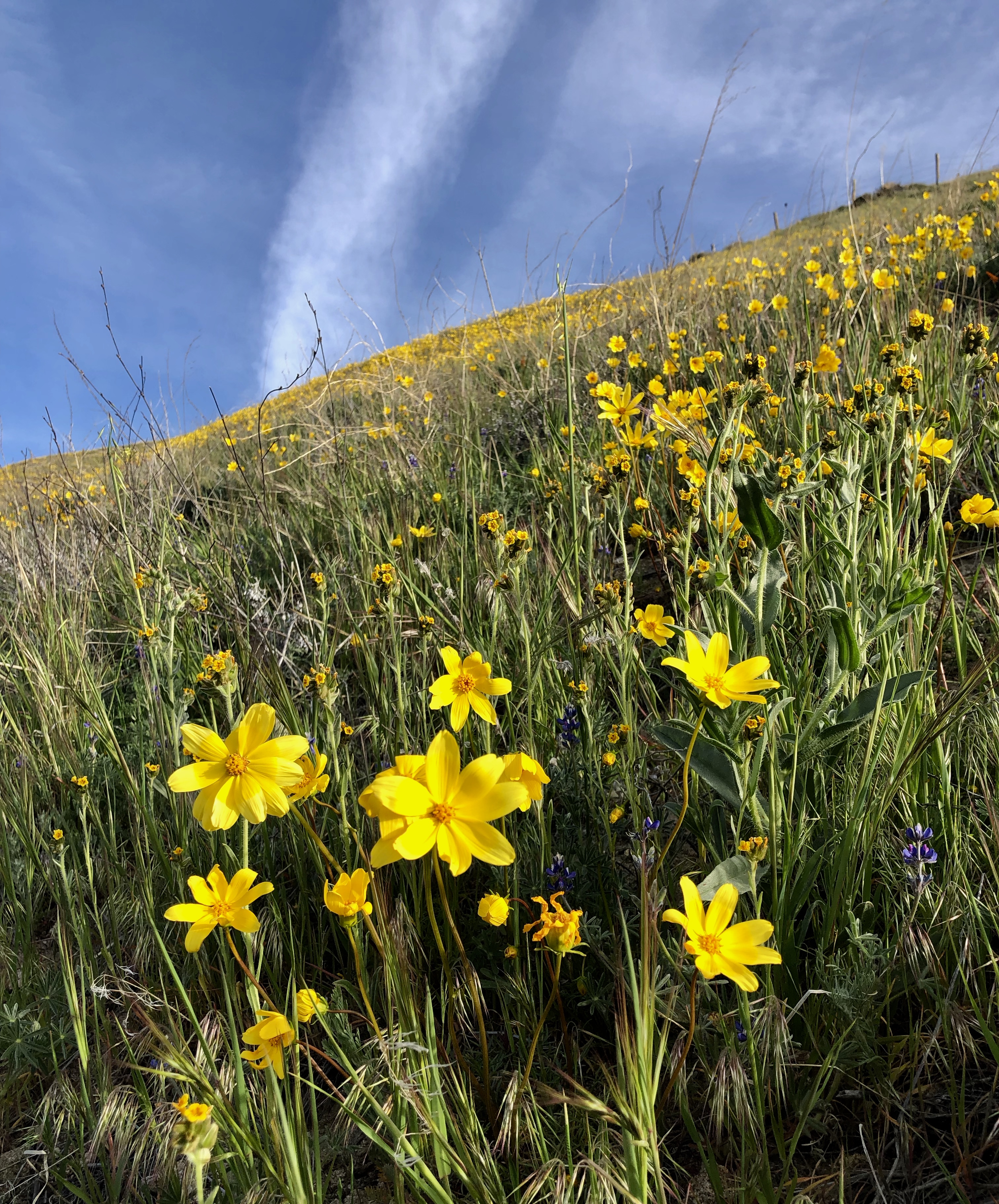
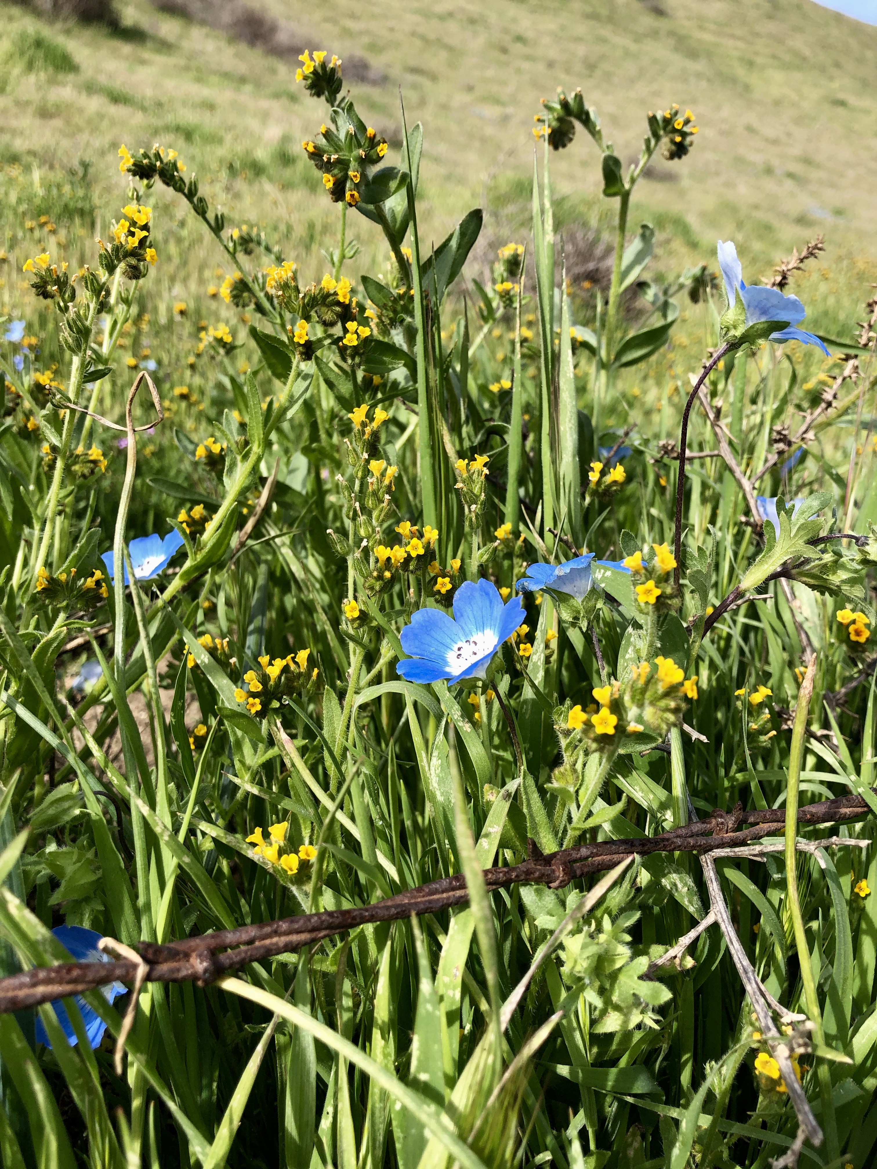
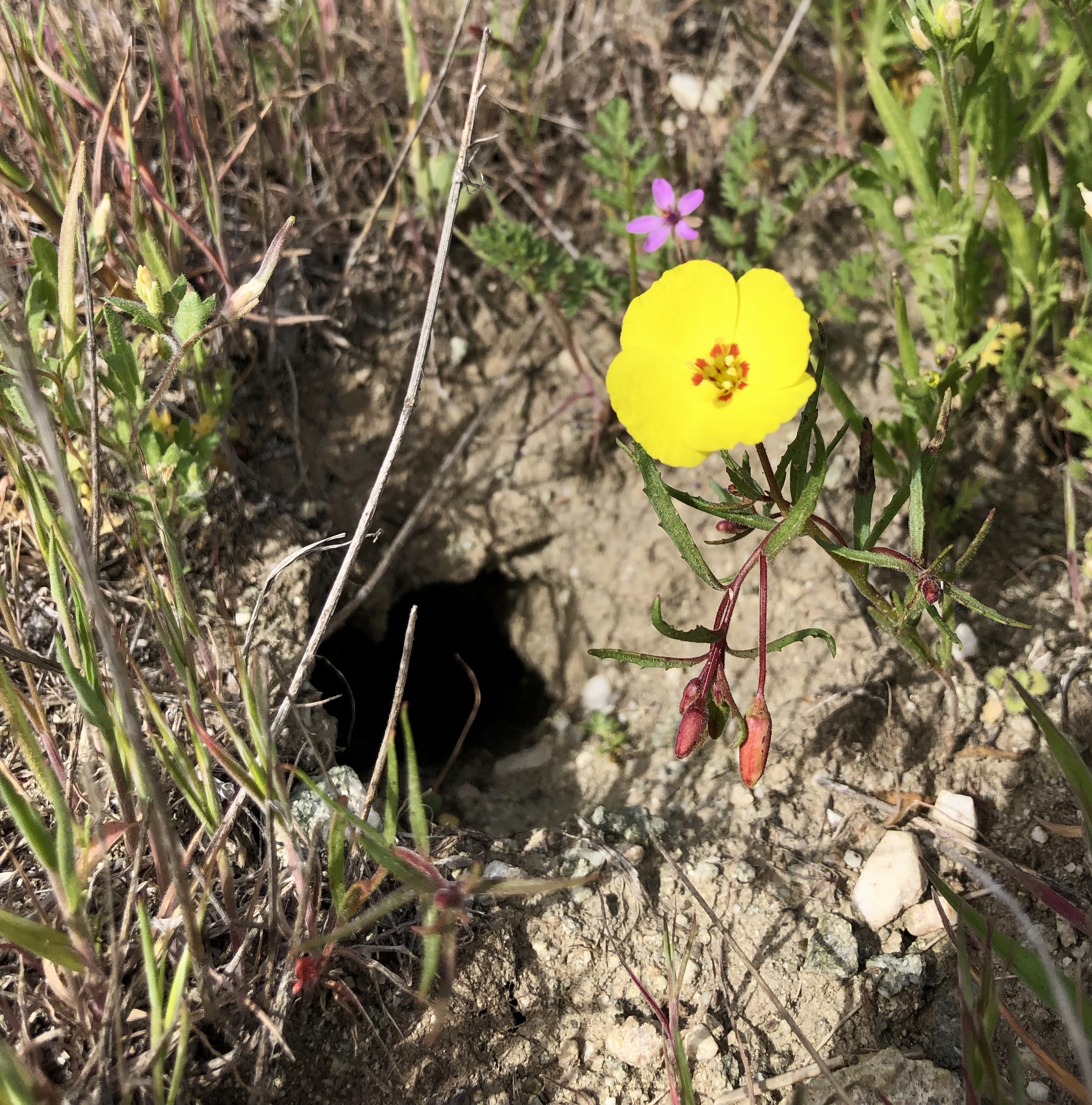
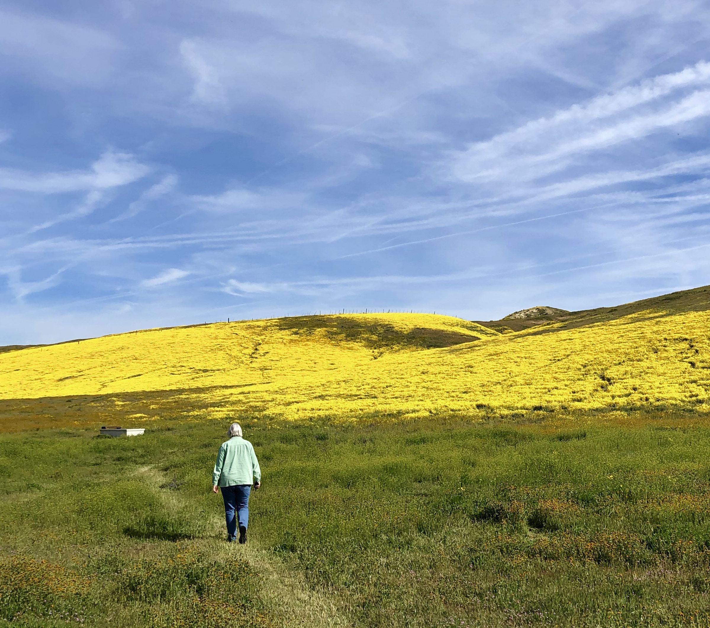
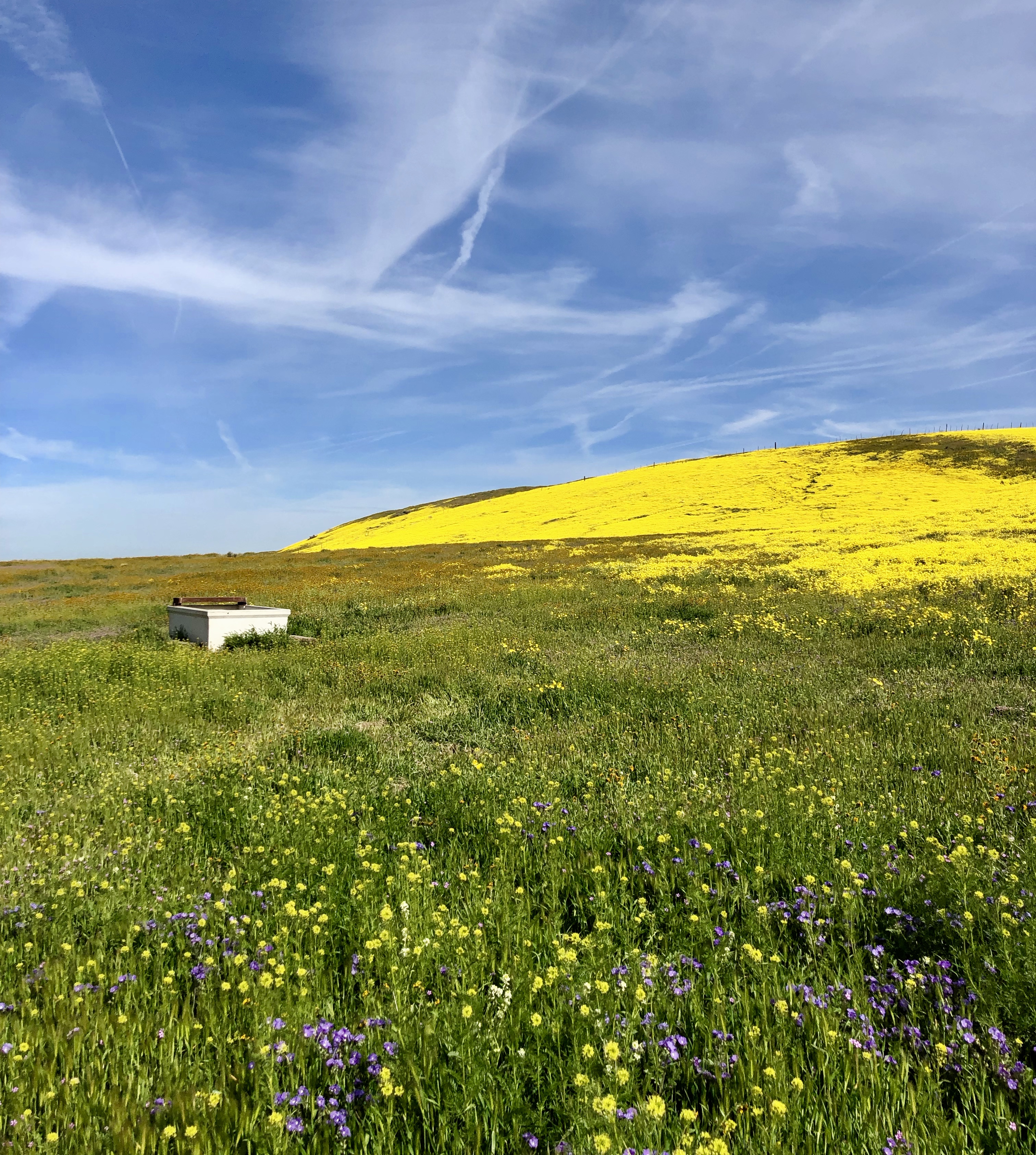
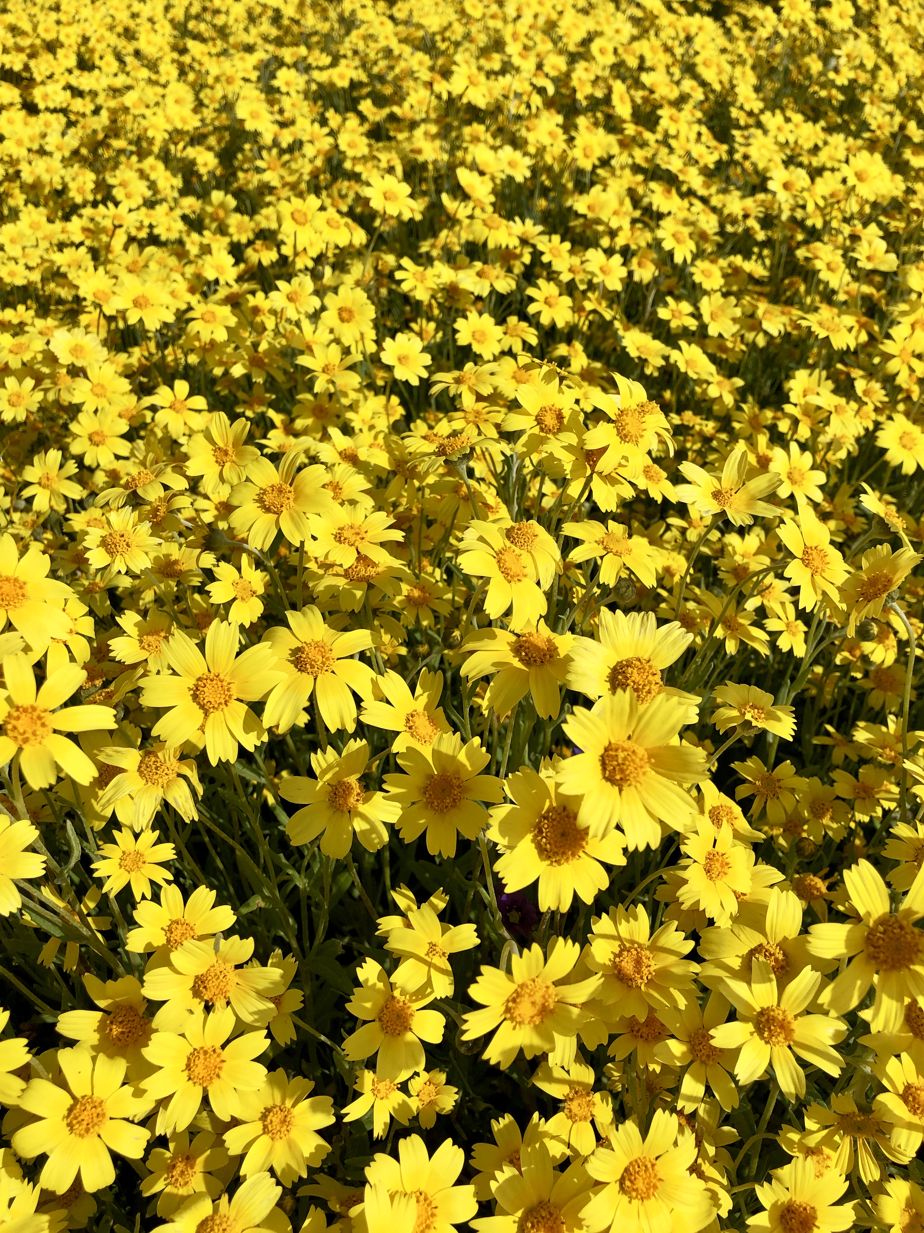
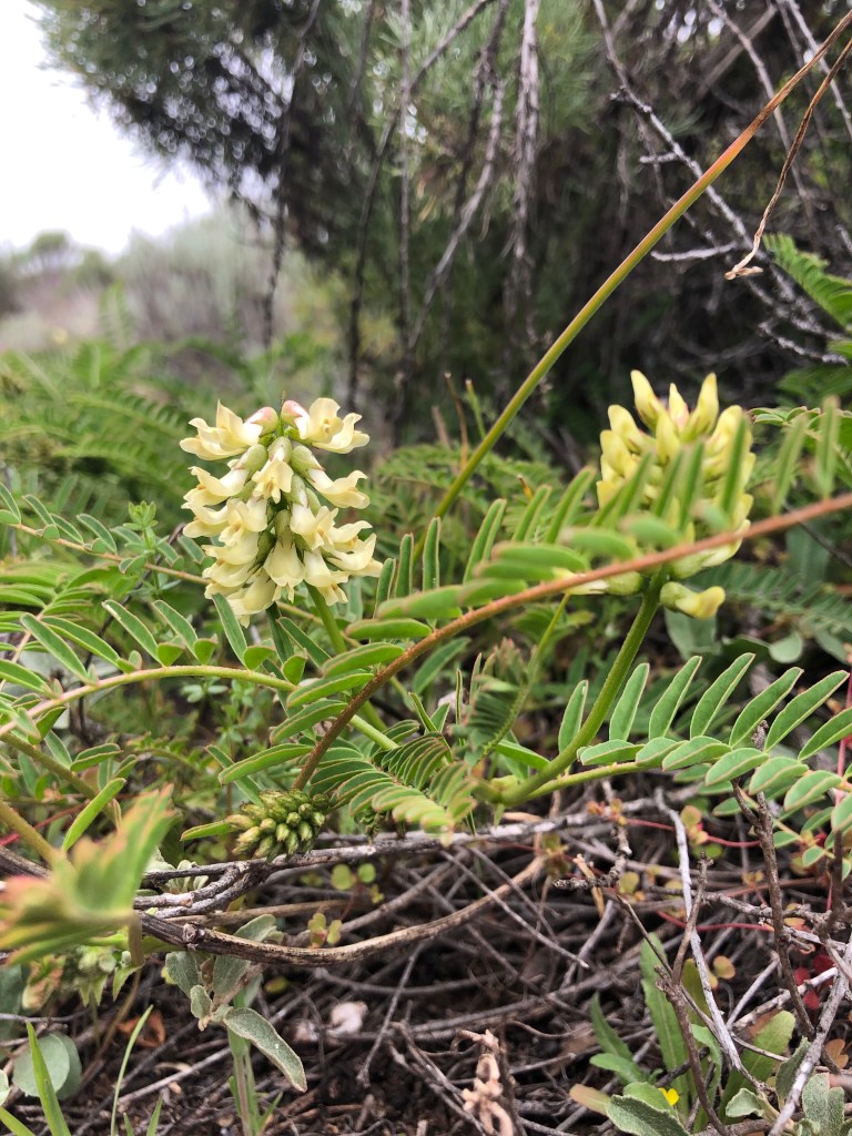
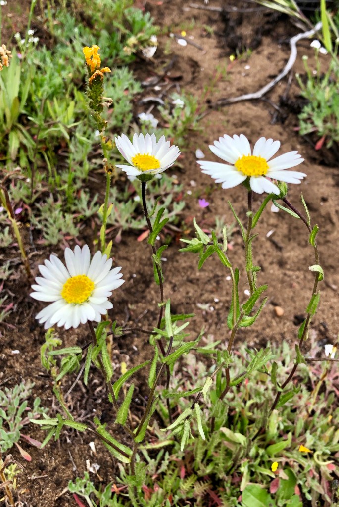
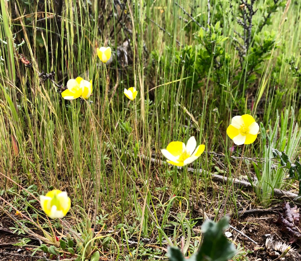
The route now is pretty easy. Stay on Soda Lake Road for about 50 miles until you get to Highway 58. The next part is a little harder. Try not to run off the road, and into another car, while looking at the vast quantity and variety of flowers. Predominately yellow, orange, blue and purple. but mostly yellow.
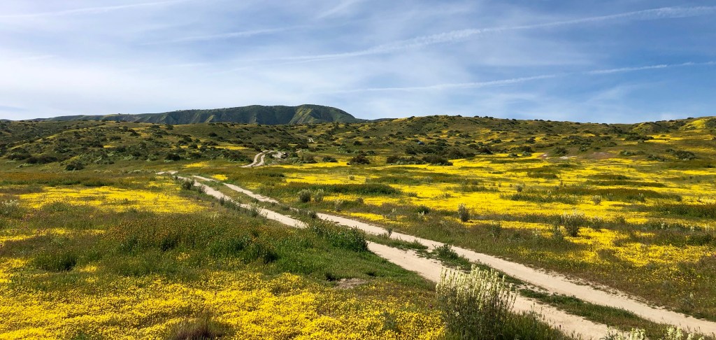
Vast sheets of shimmering, retinal after-image, flowers stretching into the distance. Mile after mile. It is truly impressive. There were lots of other flowers, all dazzling in their own right. But the amount of yellow everywhere was amazing. I took lots of pictures.


A warning. There are little, to no, services once you leave Maricopa. Bring food, water, sunscreen, whatever you need to survive for the day. There are no services in the National Reserve. There, you have been warned.
There are roads that branch right and left off Soda Lake Road. Take them to see things that no one else is seeing. Most of the ones we tried would be fine for a normal car. However, don’t take risks if you don’t have an all-wheel drive vehicle. Remember the previous paragraph, there are no services.
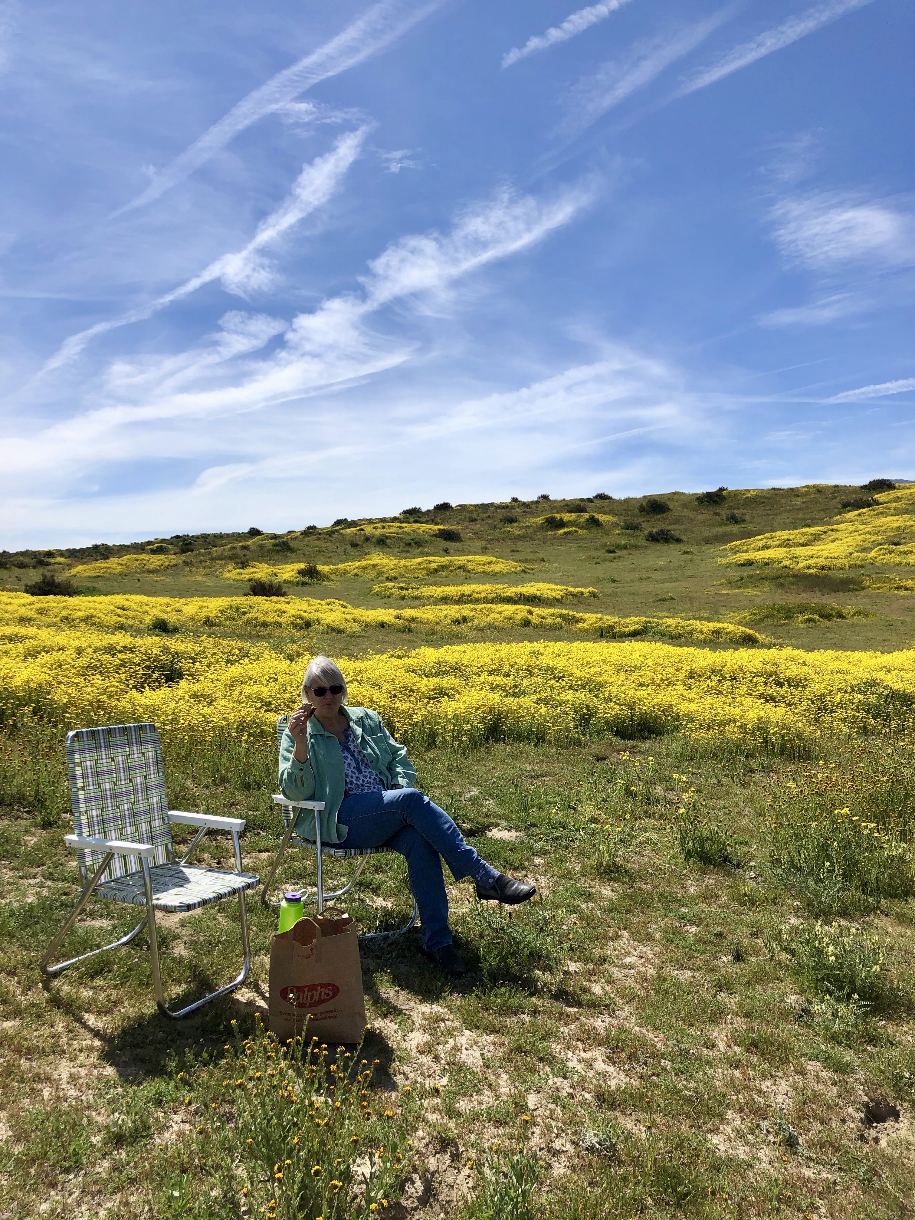
Our lunch spot was along one of these side roads. We pulled out our chairs, a couple of peanut butter and jelly sandwiches, and some fruit. We enjoyed watching some black beetles flying around in the yellow flowers. The weather was perfect. Altogether, a nice lunch.
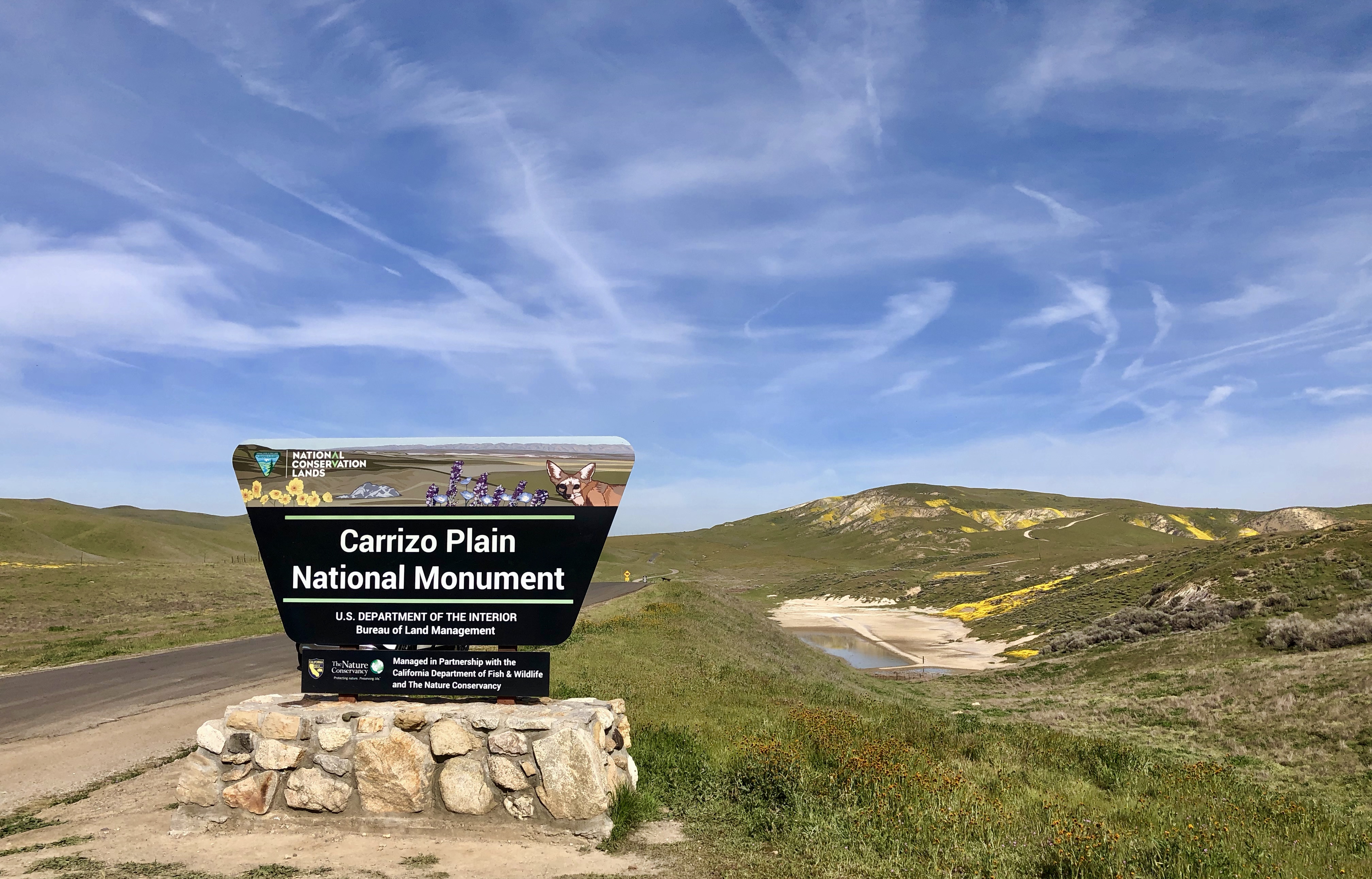
Eventually we reached the visitors center and stopped for a short while to read the signs. The visitor center itself was closed. It is only open Thursdays thru Sundays for several months of the year.
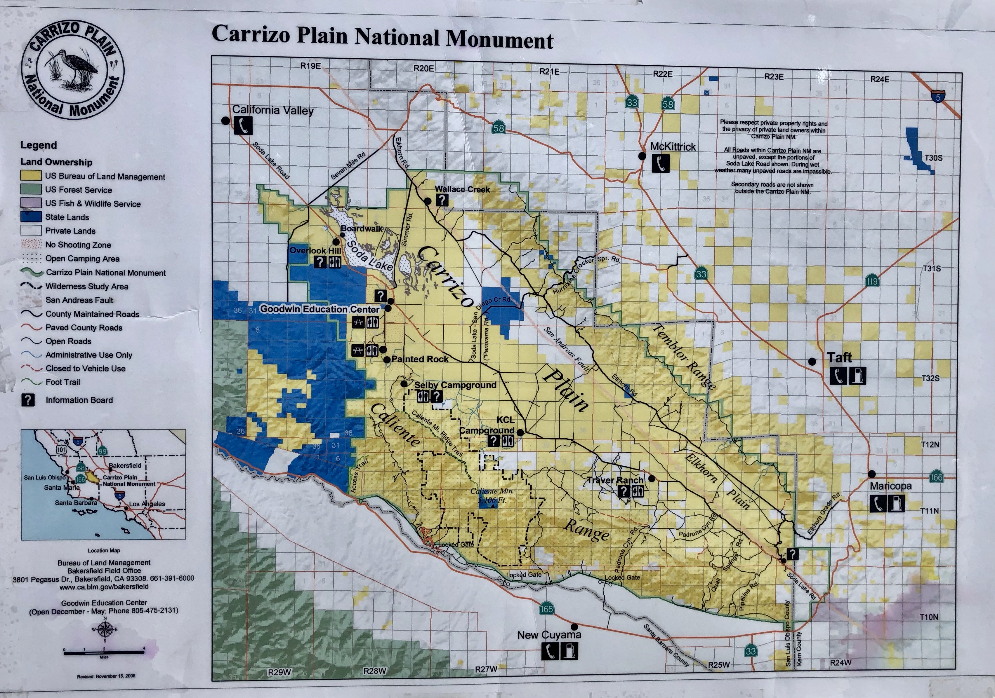
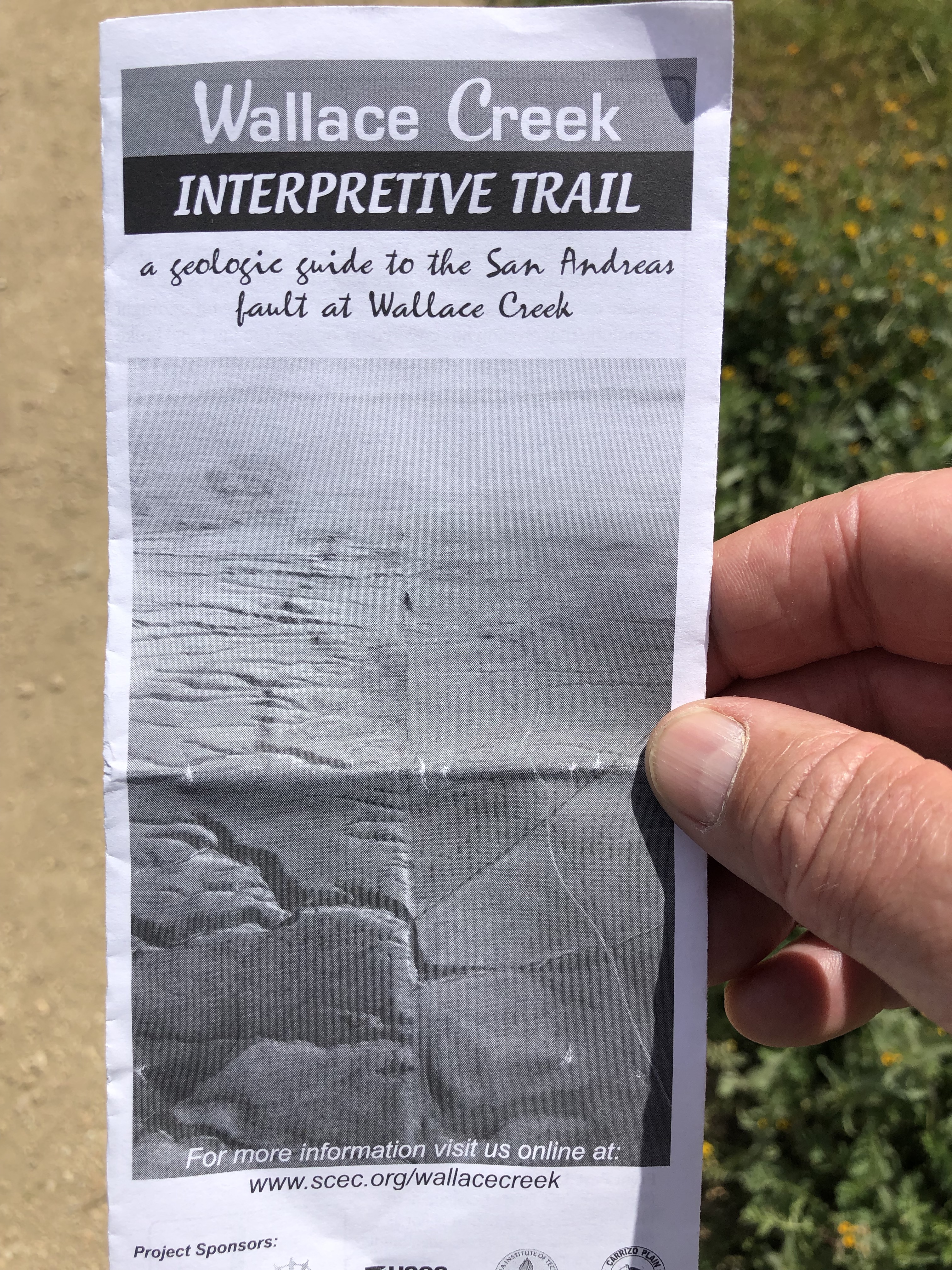
It is there that we found our next destination. The San Andreas Fault (the interface between the North American Plate and the Pacific Plate) runs northwesterly through the National Reserve. A short drive away, was Wallace Creek. The creek crosses the fault and you can see the physical evidence of fault movement. It was hard to get a usable picture here, so this picture of the brochure will have to do. The creek displacement can be seen below the fold.
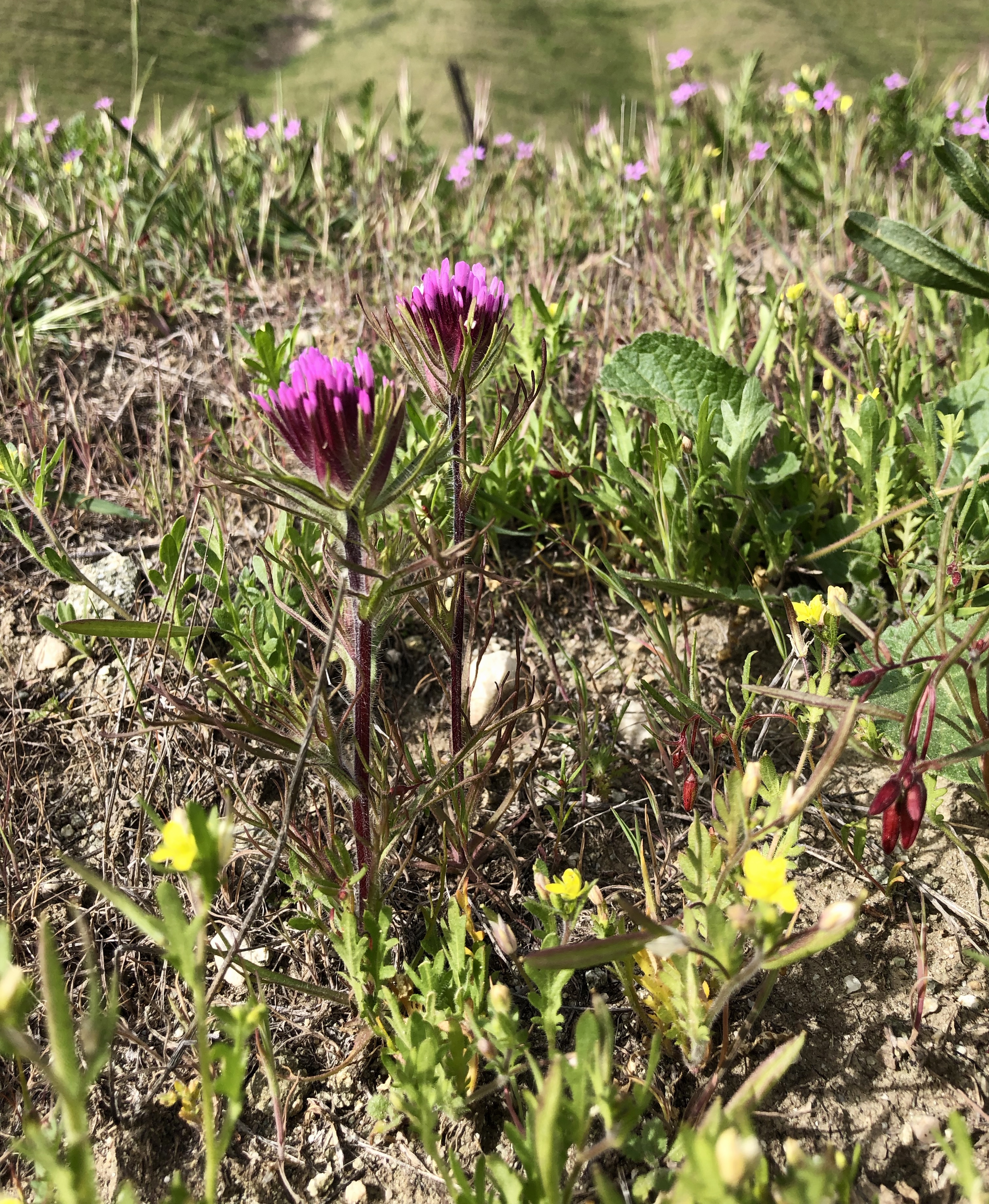
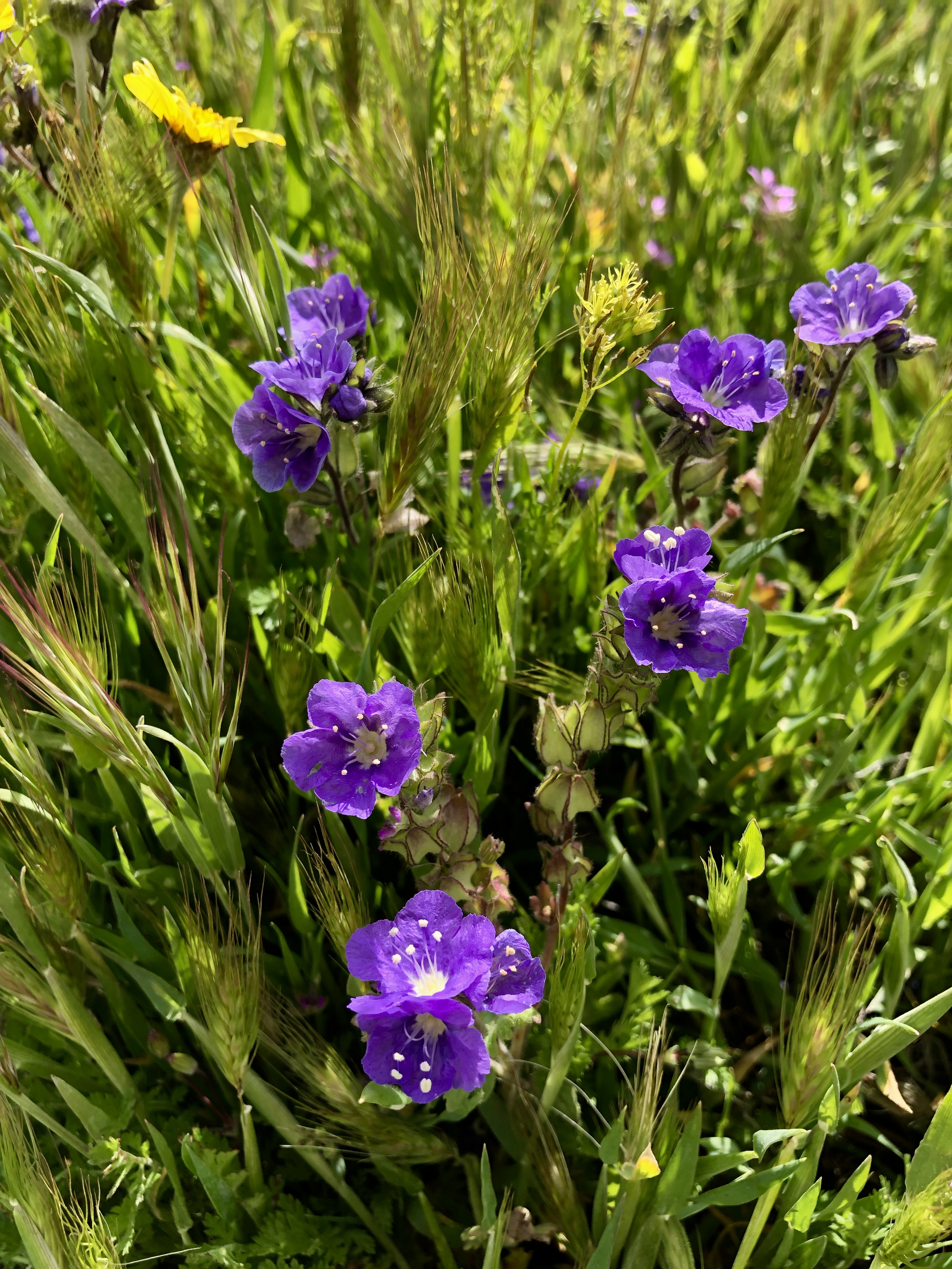
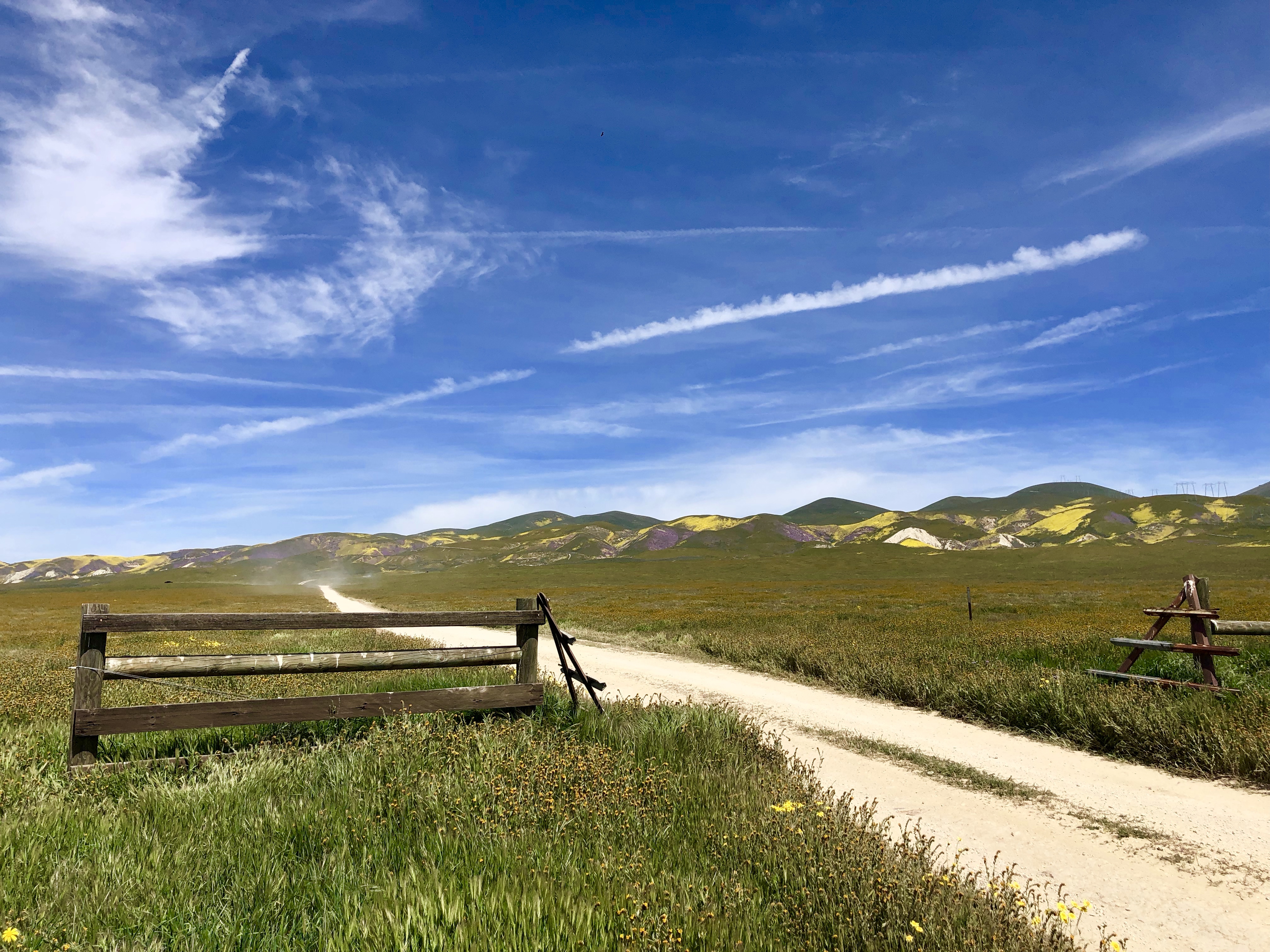
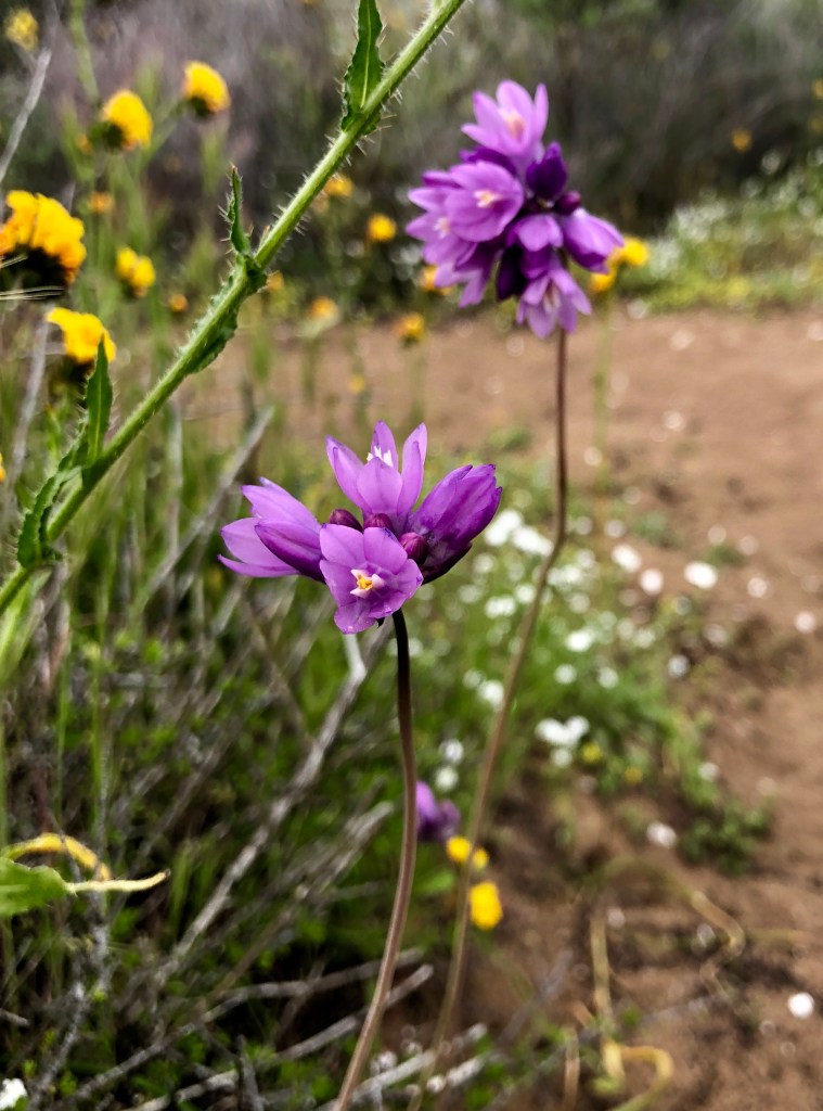
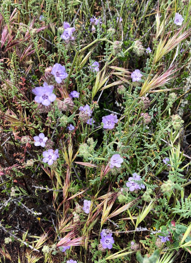
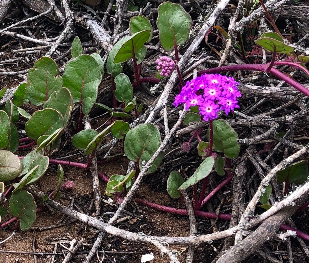
The hills were covered with yellow and purple flowers. I tried to capture the purple. This is the best I was able to do with my iPhone.
By this time, it was getting later in the afternoon, and Gretchen and I were thinking about putting some miles behind us and getting to Morro Bay. Actually, that’s what I was thinking. Gretchen was thinking about a nap.
We took a few last pictures, rolled our tires onto Highway 58, and headed west towards Santa Margarita. Soon we were on Highway 101 headed up Cuesta Grade, and down into San Luis Obispo.
Out final leg took us to Morro Bay and our hotel for the next 2 nights, The Landing at Morro Bay. We have stayed there several times in the recent past, and can highly recommend it.,
After checking in, and taking a quick nap, we made our way over to Gretchen’s mom, Barbara’s house. We were planning on meeting up with Barbara, her friend Jeff, and Gretchen’s brother Fritz, for drinks and dinner in Baywood Park.
Eventually everybody showed up, and we headed over to La Palapa, a local mexican joint. That didn’t work out and we ended up at The Blue Heron across the street. I had the short ribs and they were excellent. Unfortunately, too much time has passed and I can’t remember what everyone else had. But I do remember a great dinner with family and friends as a perfect end to the day.
Day 2 – Hangin’ with family in Los Osos, Rainy flower hike and Mexican food
After a nice night at the Landing, Jeep and I breakfasted at Dorn’s, a favorite spot. I had the homemade corn beef hash and eggs. It was decadent, and followed with sourdough toast and strawberry jam, an almost perfect breakfast (that description is for you Michael).
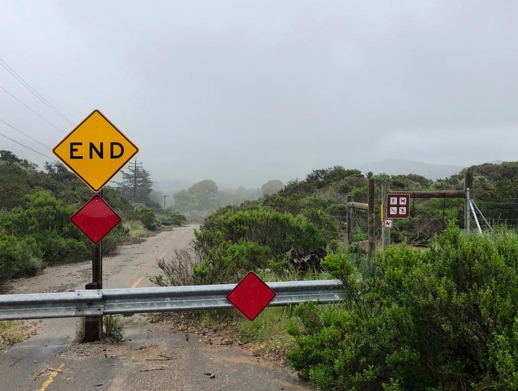
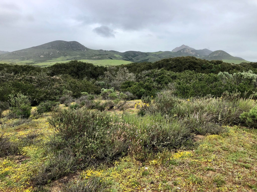
After breakfast, we made a beeline over to Barb’s and hung out, waiting for people to arrive. The plan was lunch at Barb’s, followed by a hike. The hike was planned to start to the east of the intersection of South Bay Boulevard Santa Isabel Ave in Los Osos.
The hiking crew consisted of Gretchen, Barb, sister Lynn, brother Fritz, Jeff, and I. You can see from the pictures that it was drizzly, and we all were glad to have our raincoats. Barb and Jeff gave us the flower tour.
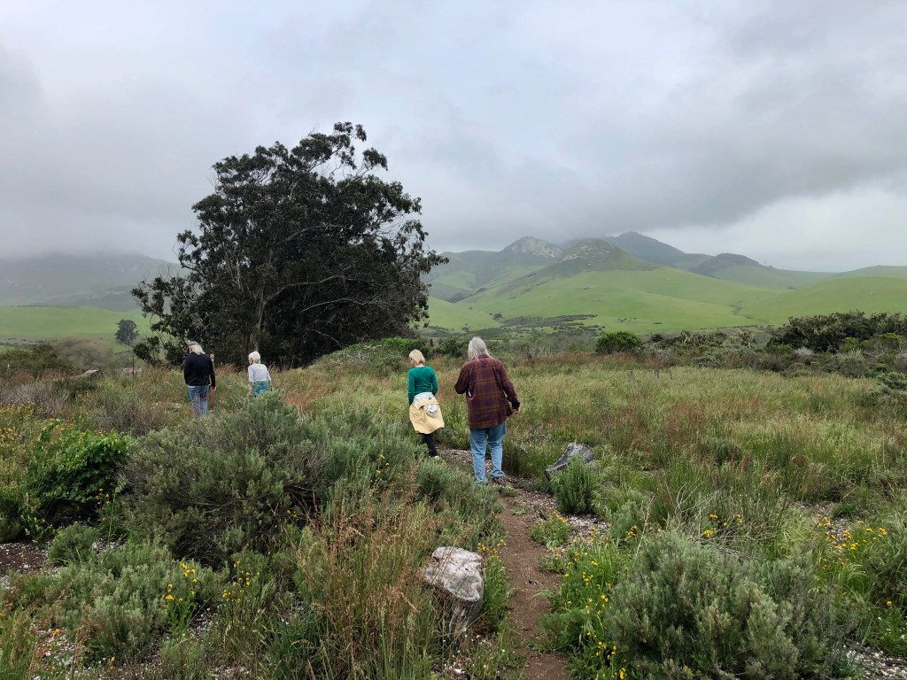

Took lots of flower pictures, as usual.


After the hike we returned to Barb’s. We spent the time visiting and catching up with everybody until it was time for dinner. Tonight we were eating at the most excellent La Palapa. Really, if you are in town someday, hankering for Mexican, you can’t miss with this place. If you like it hot, try the Shrimp Diablo, Lynn’s favorite.
After dinner, it was back to the Landing for a good night’s rest.
That’s all for the first 2 days. I’ll get the final 2 days out soon. As usual, thanks for visiting and reading. I hope you enjoyed the pictures. And if you get a chance, hop in the car and check out the flowers for yourself.
So as usual, don’t forget to vote every chance you get. Luna is counting on us. She’s focused on the prize and won’t let the orange monster distract her. Don’t let him distract you.

NICE PLACE SIR .
LikeLike